Spatio-temporal continuous high-efficiency and high-accuracy global land cover data are indispensable basic data in the research and decision-making of sustainable development, the development of earth system models, resource management, assessment of ecological environment and other work. Currently, land cover mapping data are still limited in terms of spatio-temporal span, spatio-temporal fineness and rapid change monitoring ability. Recently, based on the FROM-GLC system built by Professor Gong Peng's team, Yu Le’s Research Group of the Department of Earth System Science, Tsinghua University has proposed a multi-spatio-temporal scale land cover monitoring system FROM-GLC Plus (FGP).
In terms of temporal frequency, the FGP system can carry out flexible and high-frequency land cover change monitoring annually and daily according to monitoring requirements. In terms of spatial scale, the FGP system can, based on the high spatial resolution remote sensing data, use super-resolution algorithm to obtain land cover maps ranging from 30 m to 1 m or even sub-meter level (Fig.1). In addition, flexible mapping can be realized by combining domestic high-scoring series satellite data and Planet small satellite data. By far, some data generated by this system have been applied by the Food and Agriculture Organization of the United Nations (FAO) to regional cultivated land monitoring and change analysis.
The above research results have been published as an article titled “FROM-GLC Plus: toward near real-time and multi-resolution land cover mapping” in GIScience & Remote Sensing.
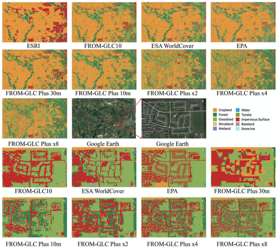
Fig. 1 Examples of FGP multi-resolution land cover maps in Chicago, U. S.
The global land cover data preliminarily completed by the FGP system (Fig. 2) feature relatively stable classification accuracy (Fig. 3). As to the annual global 30-m land cover data since 1982, visual map services can be offered via the FAO data management system (FAO CKAN).
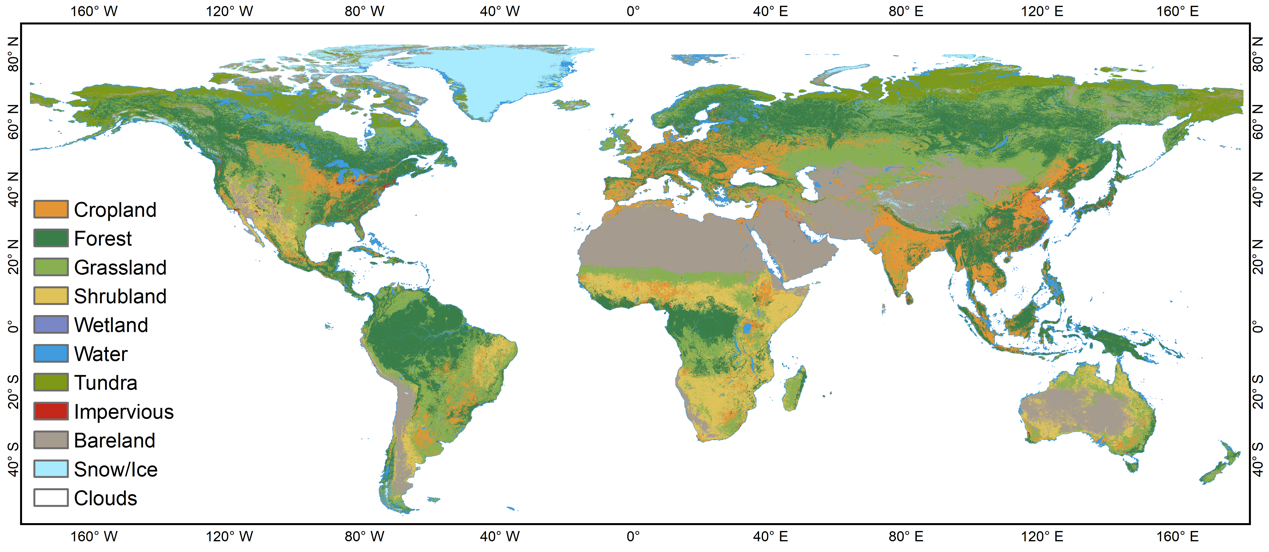
Fig. 2 FGP Global 30-m land cover map for 2021
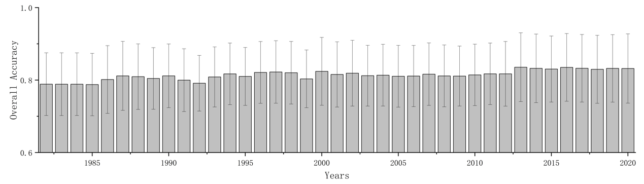
Fig. 3 Annual overall accuracy of FGP global 30-m land cover maps obtained with annual migrated validation samples (1982-2020)
Associate Professor Yu Le of the DESS, Tsinghua University is the first author and corresponding author of the paper. The collaborators include Professor Fu Haohuan’s team of the DESS, Tsinghua University, Professor Yang Guangwen from the Department of Computer Science and Technology, Tsinghua University, Dr Hao Pengyu from the Food and Agriculture Organization of the United Nations, Associate Researcher Zhong Bo and Researcher Peng Dailiang from the Aerospace Information Research Institute, the Chinese Academy of Sciences, Professor Yang Jianyu from China Agricultural University and Professor Gong Peng from the University of Hong Kong. The research is supported by the National Key Research and Development Program, the Independent Scientific Research Program of Tsinghua University and the National Najor Scientific and Technological Infrastructure Project "Earth System Numerical Simulation Device".
Full-text link: https://doi.org/10.1080/15481603.2022.2096184
Data browse link of FROM-GLC Plus global 30-m annual land cover: https://leyu.users.earthengine.app/view/from-glc-plus
Contributed by Yu Le and Du Zhenrong
Edited by Wang Jiayin
Reviewed by Zhang Qiang


 Picture News
 Hot News

